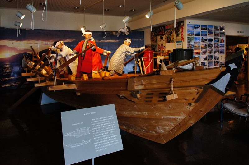
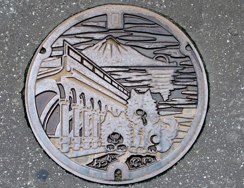
Wakkanai is the northernmost city in Japan, sitting at the very top of Hokkaido where the Sea of Japan meets the Sea of Okhotsk. Cape Soya — Japan’s northernmost point — is 30 minutes east by car. On clear days, the Russian island of Sakhalin is visible across the La Pérouse Strait, closer than Sapporo. This is remote Hokkaido at its most extreme: open grassland, dairy farms, wind, and a coastline that faces nothing but Arctic currents.
Visitors come for the geographic milestone, the islands (Rishiri and Rebun), and the wild coastal scenery. But honestly, Wakkanai itself is not a destination that will fill multiple days. The city is small and functional — a ferry port, a train terminus, some hotels, and a few restaurants. The real draw is offshore: Rishiri’s volcanic peak and world-class sea urchin, Rebun’s alpine wildflowers at sea level. Plan your time accordingly — a night in Wakkanai as a staging point for the islands, not as the main event.
Cape Soya
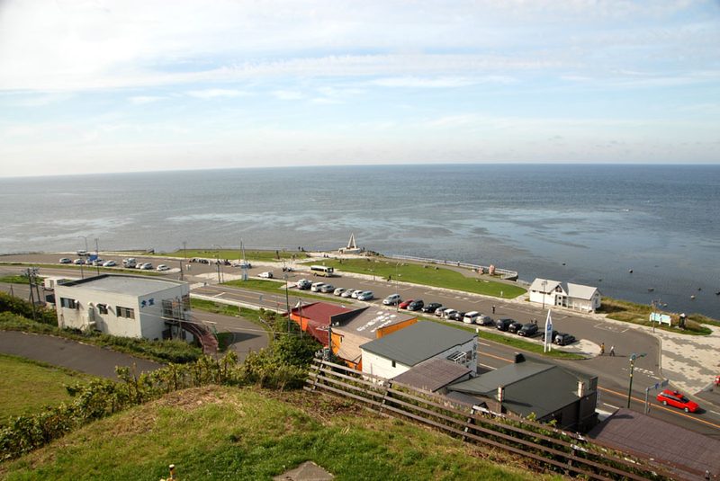
Japan’s northernmost point. A monument marks the spot, flanked by gift shops selling “northernmost” everything (northernmost ramen, northernmost soft serve, northernmost souvenir magnets). The actual experience is brief — you take a photo at the monument, read the signs about the strait and Sakhalin, and leave. The ceremony of standing at the geographic extreme is the point; the cape itself is an unremarkable headland.
The drive there from Wakkanai (30 minutes east along the coast) is more impressive than the destination. The road passes through Soya Hills, a landscape of windswept grassland dotted with grazing cattle and wind turbines. In summer the grass is brilliantly green against the blue strait; in winter it is stark and exposed. The Soya Hills Footpath is a walking trail through this landscape (various lengths, 1-3 hours) if you want more than a photo stop.
Cape Soya is accessible by bus from Wakkanai Station (about 50 minutes, approximately ¥1,350/~$9, 4-5 departures daily in summer, fewer in winter).
Rishiri Island
A near-perfect volcanic cone (Mt. Rishiri, 1,721m) rising directly from the sea, 20km offshore from Wakkanai. The mountain dominates the island from every angle — it is the kind of shape that looks artificially symmetrical, like a child’s drawing of a volcano. The island is about 60km in circumference, with a coastal road that loops the entire perimeter past fishing villages, wild coastline, and views of the peak from every direction.
Hiking Mt. Rishiri
The summit hike is the main challenge. The standard route from Oshidomari (the ferry port) takes 8-10 hours return and gains about 1,500m. This is a serious day hike requiring fitness, proper gear, and an early start (05:00 recommended). The trail is well-marked but steep, with sections of loose volcanic rock near the summit. The views from the top — the island below you, the sea in every direction, Rebun to the west, Sakhalin to the north — are among the most dramatic in Hokkaido. Experienced hikers only. Bears are not present on Rishiri (one of the few bear-free areas in Hokkaido), which is reassuring.
Rishiri Sea Urchin
Rishiri uni is considered among the finest in Japan. The sea urchins feed on the kelp (rishiri kombu) that grows in the cold, clean waters around the island, and the flavour is noticeably sweeter and more complex than mainland uni. The season runs June through August. During this window, virtually every restaurant and minshuku on the island serves uni, often caught that morning. A uni-don (sea urchin rice bowl) runs approximately ¥3,000-5,000 (~$20-34) and is worth every yen. Outside of season, frozen uni is available but lacks the texture of fresh.
Rishiri kombu itself is a prized ingredient throughout Japan — it is the base for much of the dashi (stock) used in Kyoto’s high-end kaiseki cuisine. You can buy it directly from producers on the island.
Other Rishiri Activities
- Cycling the island — the 60km coastal road makes a full-day cycling loop. Mostly flat with a few hills. Rental bikes available at Oshidomari port. See our cycling guide.
- Otatomari Marsh — a wetland on the south side with a classic Mt. Rishiri reflection photo. The viewpoint is a short walk from the road.
- Senshi Misaki — a rocky headland on the west coast with dramatic sea cliff views.
- Onsen — Rishiri Fuji Onsen near Oshidomari has ocean-view baths. Day use approximately ¥500 (~$3.40).
Ferry: Heart Land Ferry from Wakkanai to Oshidomari takes 1 hour 40 minutes (approximately ¥2,600/~$18 one way, 2nd class). 2-3 departures daily in summer, reduced in winter. Book in advance during July-August.
Rebun Island
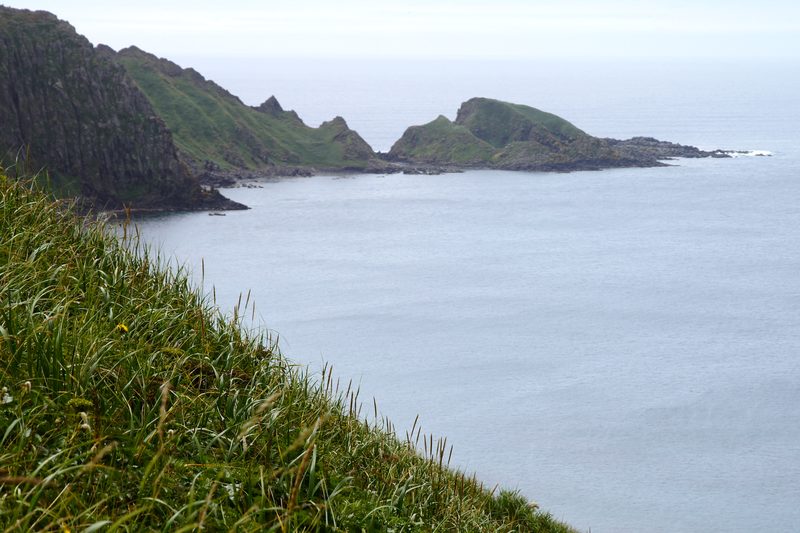
Lower and flatter than Rishiri, Rebun is famous for alpine wildflowers that grow at sea level — species that normally require 2,000m+ of elevation flourish here due to the cold, maritime climate. The island has multiple hiking courses ranging from 2 to 8 hours, all along the coast or across gentle highland terrain. The Cape Sukoton trail (about 4 hours one way) along the northern coast is the most popular, with sea cliffs, wildflower meadows, and ocean views.
Rebun Flowers
Peak wildflower season is June through early August. Rebun atsumoriso (a Lady’s Slipper orchid found only on this island) blooms in late May to June. Other notable species include Rebun usuyukiso (edelweiss relative), alpine roses, and dozens of others that cover the hillsides in colour. The Rebun Flower Guide Centre near the ferry port has maps showing current bloom locations.
Hiking
Rebun’s trails are gentler than Rishiri’s mountain hike. The 8-Hour Course runs the full length of the island’s west coast and is the most comprehensive option if you have the time. The 4-Hour Course (Cape Sukoton to Nairo) is the best compromise of scenery and effort. All trails are well-marked but exposed — bring wind protection and rain gear regardless of the forecast.
Ferry: Heart Land Ferry from Wakkanai to Kafuka takes 1 hour 55 minutes (approximately ¥2,600/~$18 one way, 2nd class). There are also ferries between Rishiri and Rebun (about 45 minutes), making a two-island trip practical.
Sarobetsu Wetland
A coastal peatland about 30 minutes south of Wakkanai with boardwalk trails through wetland and dune grassland. Wildflowers bloom June through July — ezo-kanzo (Hokkaido day lily) colours entire meadows orange. Free entry. The visitor centre has exhibits on the wetland ecology. A quieter alternative to the islands if your time is limited.
Food

- Sea urchin (uni) — Rishiri uni is the star. Available fresh June-August on the island. Wakkanai restaurants also serve it in season.
- Horsehair crab (kegani) — Wakkanai is known for kegani. Several restaurants near the port serve it fresh. A whole crab runs approximately ¥3,000-6,000 (~$20-41).
- Dairy — The Sarobetsu area has dairy farms producing excellent milk and cheese. Roadside stalls sell fresh milk soft serve in summer.
- Sakhalin-influenced cuisine — Some restaurants in Wakkanai serve dishes influenced by the proximity to Russia, including salt-cured herring and borscht-like soups.
See our food guide for Hokkaido-wide eating recommendations.
Getting There
By air: ANA flights from Tokyo Haneda to Wakkanai Airport (1 hour 50 minutes). The airport is 10 minutes from the city centre by bus.
By train: JR Soya Line from Asahikawa to Wakkanai (3 hours 40 minutes). This is one of Japan’s most scenic railway lines, crossing the Teshio Plain through increasingly remote landscapes. The final hour, running along the coast with views of the sea and offshore islands, is exceptional. Covered by the JR Hokkaido Rail Pass. From Sapporo, connect via Asahikawa (total journey about 5-5.5 hours).
By bus: Long-distance bus from Sapporo to Wakkanai (about 5.5 hours, approximately ¥6,000/~$41). Overnight services available.
By car: About 5.5 hours from Sapporo via expressway and Route 40. The coastal route via Rumoi and Haboro is longer but more scenic.
When to Go
June–September is the only practical window for most visitors. Island ferries run full schedules, wildflowers bloom on Rebun (peak June-July), uni season is June-August, and the weather is as good as it gets. July and August are warmest (18-22°C) but can be foggy.
Winter is severe — strong winds, heavy snow, and ferry services are reduced. The islands remain accessible but tourist facilities largely close. The drive to Cape Soya in winter is atmospheric (frozen sea, windswept coast) but bitterly cold.
How Long
Wakkanai alone: Half a day covers Cape Soya and the city. Not enough to justify the journey.
Wakkanai + one island: 2 days minimum. Ferry to Rishiri or Rebun, spend a day on the island, return to Wakkanai, continue your journey.
Both islands: 3-4 days ideal. One day each on Rishiri and Rebun, plus transit days. The inter-island ferry makes it easy to visit both without returning to Wakkanai between them.