Hiking in Hokkaido is a different proposition from hiking in Honshu. The trails are less crowded, the mountains are wilder, and the wilderness feels more genuine. You won’t queue for popular summits on weekends, and on weekdays you may go hours without seeing another person. That solitude is the draw — but it comes with responsibilities. Brown bears live throughout Hokkaido’s mountains, trail infrastructure is thinner than you might expect, and many routes sit under snow well into June.
What Makes Hokkaido Different
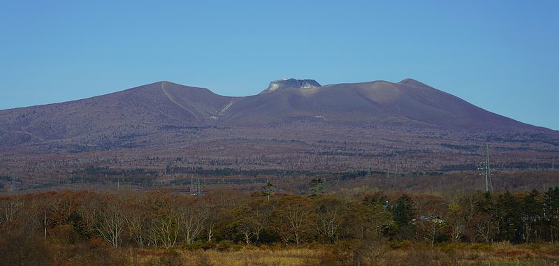
Hokkaido’s mountains are geologically young and volcanically active. Daisetsuzan, the central highland that forms the backbone of the island, holds Japan’s largest national park and its most remote hiking terrain. The peaks — Asahi-dake, Kurodake, Tokachi-dake — are not technically demanding by alpine standards, but they’re exposed, weather changes fast, and rescue services take time.
The hiking season is also shorter. At altitude, snow can persist until late June, and early September storms are not uncommon. Unlike the well-maintained network across the Japanese Alps, Hokkaido’s trail signs are sometimes Japanese-only, mountain huts are fewer, and most trailheads are only reachable by car or seasonal bus.
Easy Walks (Under 2 Hours)
Shiretoko Five Lakes — 90 Minutes
On the Shiretoko Peninsula in the far northeast. The raised boardwalk (800m) is open without restriction. The full ground-level loop (3km, ~90 minutes) requires a bear-awareness lecture from late April to mid-July when bears are most active — that’s not a formality, bears genuinely appear here. See our eastern Hokkaido guide.
Onuma Park — 1–2 Hours
Near Hakodate. Flat, well-marked trails around a lake complex with Mt. Komagatake reflected in the water. The 8km circuit takes about 2 hours. Shorter loops exist. Good for families or a gentle start.
Sugatami Pond Loop (Daisetsuzan) — 1 Hour
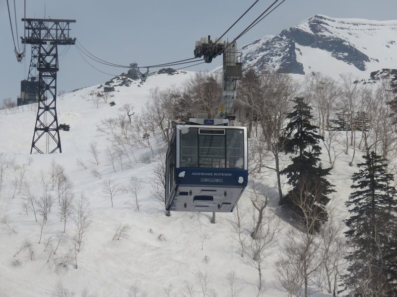
From the Asahi-dake ropeway upper station. Volcanic terrain with fumaroles, small ponds, and alpine flowers (July–August). Mostly boardwalk. The ropeway does the climbing — you step out at 1,600m and walk.
Moderate Day Hikes (3–5 Hours)
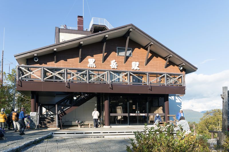
Kurodake — 3–4 Hours Return
The most accessible real mountain in Hokkaido. A gondola and chairlift from Sounkyo Onsen carry you to the 5th/7th station; from the chairlift top it’s 90 minutes to the summit across open rocky ridge. Summit views stretch across the Daisetsuzan plateau. Ropeway + chairlift ~¥3,300 (~$22) round trip. Often the first summit to show autumn colour in Japan, typically mid-September.
Mt. Tarumae — 2–3 Hours Return
Active volcano above Lake Shikotsu. From the 7th Station trailhead (car access only), the trail climbs steeply onto a bare volcanic dome. The crater is active — sulphur smell and steam venting. Views across the lake and to the Pacific. Summit loop around the dome takes 30 minutes. Strong half-day option from Sapporo.
Mt. Eniwa — 3–4 Hours Return
North side of Lake Shikotsu. About 1,000m elevation gain — steeper and more demanding than Tarumae. Fewer hikers, genuine solitude. Bears present; carry a bell. July–October.
Challenging Day Hikes (6–10 Hours)
Asahi-dake Summit (2,291m) — 5–6 Hours Return
Hokkaido’s highest peak. Ropeway to 1,600m, then ~700m of alpine ascent across volcanic rock and pumice fields. Summit ridge is exposed; navigation in cloud requires care. July–August brings alpine flowers below the summit; early September brings first autumn colour. Check conditions at the visitor centre before ascending. Ropeway ~¥3,200 (~$22) round trip.
Mt. Yotei (1,898m) — 8–10 Hours Return
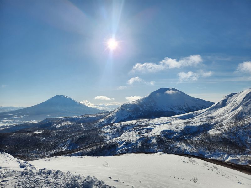
The “Hokkaido Fuji” — near-perfect volcanic cone visible from Niseko. A serious day hike: ~1,600m vertical gain, steep and relentless, no shortcuts or cable cars. Start by 05:00–06:00. Crater rim walk at the top rewards the effort. July–October. Experienced hikers only.
Tokachi-dake (2,077m) — 6–7 Hours Return
Active stratovolcano at the southern end of Daisetsuzan. From Tokachidake Onsen (1,280m), ~1,000m gain over old lava flows and sulphur-stained ridges. Views across Furano’s patchwork hills. Check the JMA volcanic alert level before visiting — trail closes at level 2+. Finish with an onsen soak at the trailhead lodge (~¥800 day use). Car access only from Furano (45 minutes).
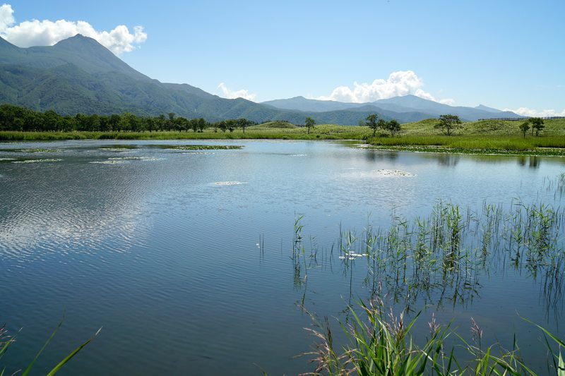
Multi-Day: The Daisetsuzan Grand Traverse
The traverse from Asahi-dake to Tokachi-dake through the heart of Daisetsuzan is one of Japan’s great long-distance mountain routes. Roughly 30km across high alpine terrain, 2–3 days. The route is typically walked north to south: ropeway up Asahi-dake, traverse the plateau, exit via Kurodake gondola at Sounkyo — mechanical assistance at both ends, wildest section in between.
The path is waymarked but not always obvious in poor visibility. The plateau above 2,000m is fully exposed. Navigation skills help.
Mountain huts along the traverse (Nakadake Onsen, Shirakabaga, others) are basic: platform sleeping, sometimes a simple meal, pit toilets, no showers. Most open July to mid-September. Booking is essential — huts fill on summer weekends. Contact directly or through the Daisetsuzan visitor centre. Some accept online bookings; others require a phone call (your accommodation can often call on your behalf).
Best done mid-July to mid-September. Late September can work but conditions become unpredictable. Full details in our Daisetsuzan guide.
Bear Safety
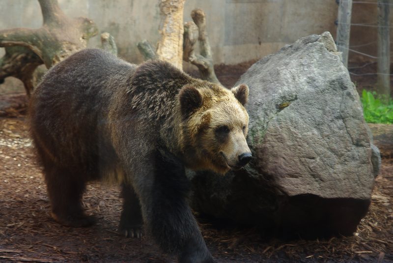
Brown bears (higuma) live throughout Hokkaido’s mountains. Encounters happen every year, including on popular trails. This isn’t a reason to avoid hiking, but it does mean taking bear awareness seriously.
- Carry a bear bell and keep it ringing through vegetation and around blind corners. Bears avoid humans they can hear coming.
- Carry bear spray and know how to use it. Available at outdoor shops in Sapporo and Asahikawa (~¥7,000–10,000). Wear it on your hip where you can draw it quickly, not buried in your pack.
- Don’t hike alone in Daisetsuzan or Shiretoko. Groups of three or more are meaningfully safer.
- Make noise approaching stream crossings, dense scrub, and berry bushes in late summer — where surprise encounters happen.
- If you see a bear at distance: stop, stay calm, speak in a low voice, back away slowly. Don’t run. Don’t turn your back.
- If a bear charges: spray when it’s within 5–10 metres. Stand your ground — most charges are bluffs.
- Never leave food accessible at camp or trailheads. Hang food 4m off the ground, 1.5m from the trunk.
Check local bear activity reports before heading out. Many trailheads post recent sighting notices. See our wildlife guide for more.
Seasonal Calendar
| Period | Conditions | Best For |
|---|---|---|
| June | Lower trails open, highland routes still snow-covered until mid-to-late month | Tarumae, Moiwa, Onuma Park |
| July | Highland routes clear ~second week. Alpine flowers peak mid-month | Asahi-dake, Kurodake, Grand Traverse (from mid-July) |
| August | Peak season. All trails open, warmest weather | All hikes including Grand Traverse |
| September | First autumn colour at altitude ~Sept 15. Weather more variable | Daisetsuzan foliage, excellent hiking if prepared |
| October | Alpine routes close progressively. Forest foliage peaks early month | Lower mountain hikes, forest walks |
| Nov–May | Winter. Routes require ski touring or snowshoe equipment | Specialist terrain only |
Gear and Preparation
- Waterproofs you trust. Weather systems move fast — clear skies to cloud and rain within two hours. Non-negotiable above the treeline.
- Trekking poles. Loose pumice and scree on volcanic peaks makes descent harder than the gradient suggests.
- Offline maps. Yamap has good Hokkaido coverage in Japanese; Maps.me covers basics in English. Cell signal on the mountain is unreliable.
- Route plan. Tell your accommodation where you’re going. Use trailhead registration boxes (tozan todoke) — rescue services use them.
- Water. Carry more than you think. Streams on volcanic terrain can be mineral-contaminated. Some huts sell water; don’t rely on it.
Getting to Trailheads
Most trailheads need a car. Public transport in rural Hokkaido is sparse. Renting a car opens up Daisetsuzan, Shiretoko, Yotei, and Tarumae without logistical puzzles. See our car rental guide.
Exceptions for car-free hikers:
- Asahidake Onsen: buses from Asahikawa (a few times daily, check schedule)
- Sounkyo Onsen (Kurodake): express buses from Asahikawa and Sapporo in summer
- Shiretoko Five Lakes: shuttle buses from Utoro in summer
- Onuma Park: accessible by JR train from Hakodate
If car-free, focus on the Sounkyo–Asahidake corridor where ropeways and limited buses make it workable. For everywhere else, a rental gives the freedom this landscape deserves.